

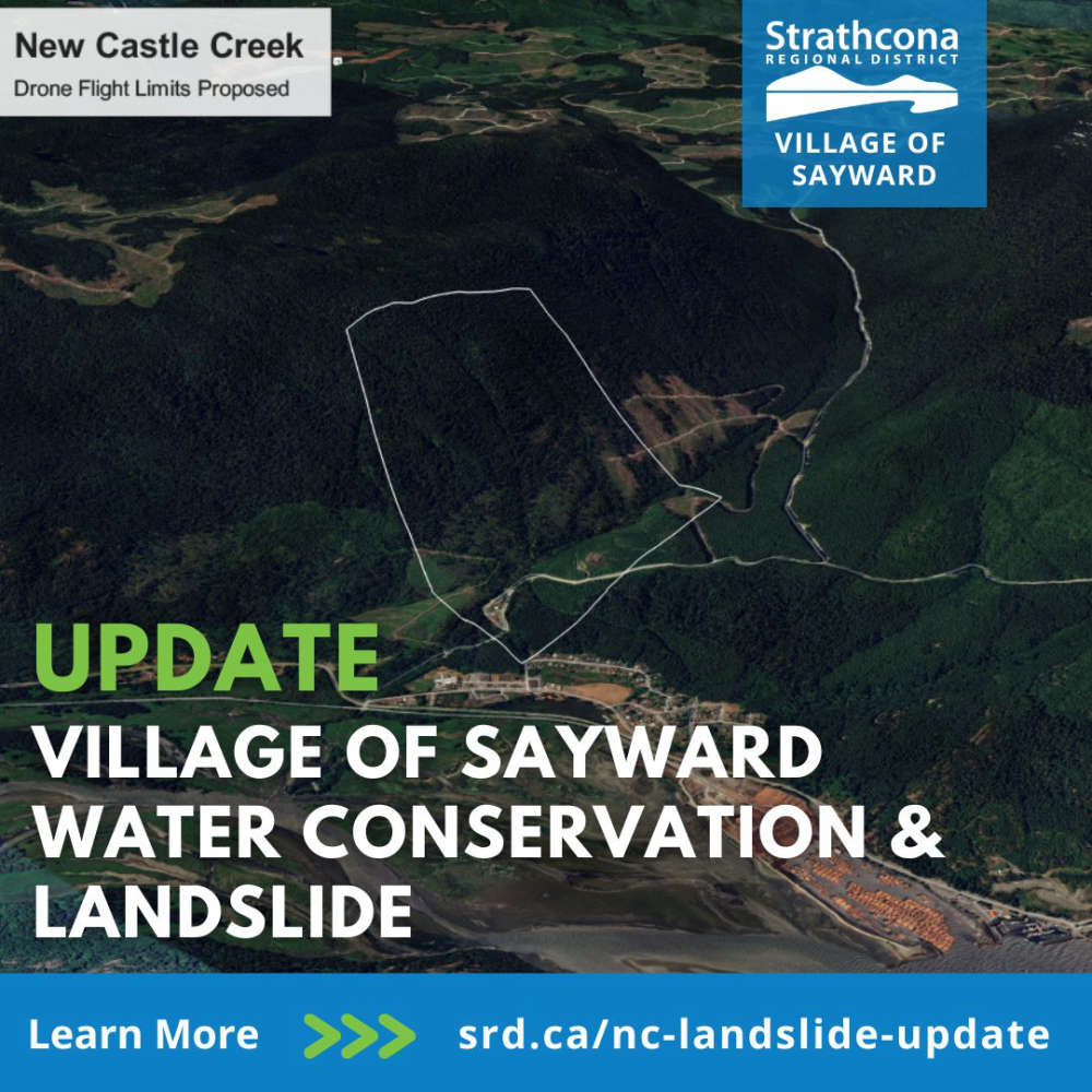
The Village of Sayward, in partnership with the Strathcona Regional District, is providing an update on the Newcastle Creek landslide.
The SRD has received emergency funding from the Ministry of Emergency Management & Climate Readiness to undertake a hazard evaluation of the landslide area, which is entirely on Crown land.
This includes an investigation of the current condition of the slope within and surrounding the Newcastle Creek landslide area.
The data obtained from drone flights will be used to characterize the slide and to develop cross-sections of the slide area and adjacent slopes.
That will help with risk analysis and the development of mitigation measures. In addition, a review of available historical data of the watershed will be completed.
That will include geotechnical assessments, hydrological data, harvesting records and significant event records.
The work will also focus on reducing short term risks associated with water impoundment and debris.
This phase should be completed by May with emergency management personnel then providing the community with an update on next steps.
Read more at Strathcona Regional District.
 Comox Valley RCMP Search For Missing Teen
 Strong Improvement Seen In SD72 Foundation Skills Assessment Results
 Campground Reservations Opening Soon At Cumberland Lake Park Campground
 SD72 Staff To Take Part In Indigenous Learning Day Today
 City Of Courtenay Website Earns International Digital Award